


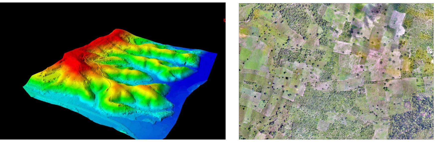
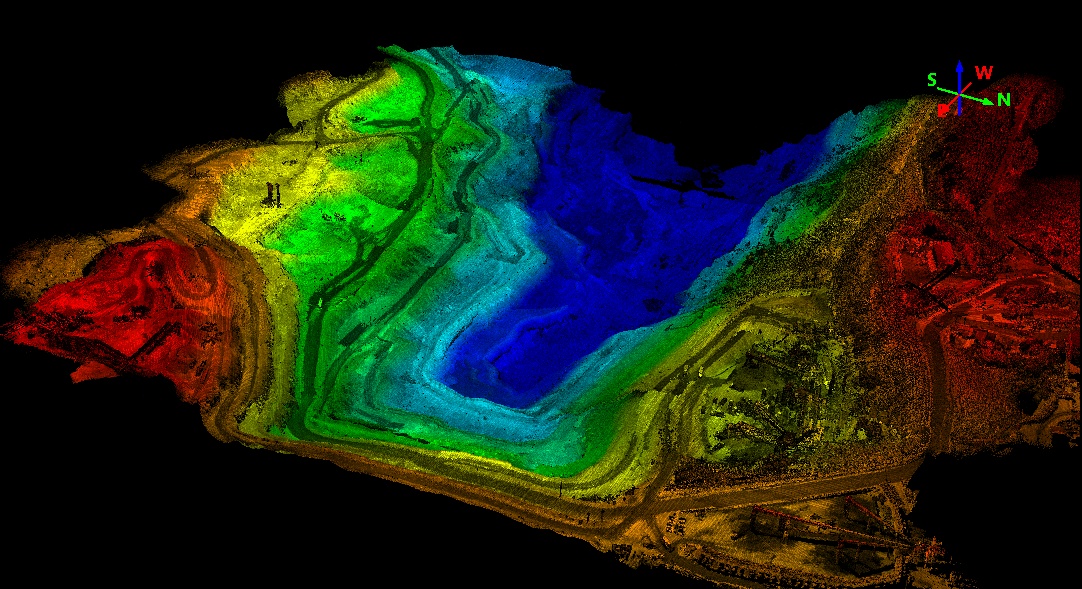
From evaluating potential mining sites to generating models of open-pit mines, the integration of UAV LiDAR technology is pivotal in modern mining operations. Partnering with Geospatial Research LTD and leveraging our nationwide network of experienced, licensed pilots and project managers, mining companies are harnessing the power of LiDAR to acquire crucial data, simultaneously lowering costs, […]
Although the integration of drone technology in the mining sector is relatively nascent, its potential benefits are substantial. As adoption rates rise, both individual companies and the industry at large stand to experience significant improvements in safety measures and cost reductions. Since 2016, major corporations with ample resources have been at the forefront of drone […]
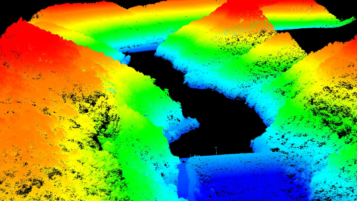
Mines operate in a dynamic environment with ever-changing terrains, demanding accurate and up-to-date information for efficient operations. Inaccurate measurements, particularly in coal or iron ore mines, can lead to inefficiencies and impact project outcomes. Traditional survey methods, reliant on GNSS and total station equipment, often pose safety risks, are time-consuming, and lack the global visualization […]
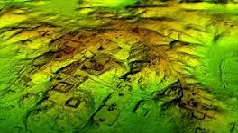
In the dynamic realm of mining, the integration of LiDAR technology with drones is emerging as a game-changer. This article delves into the profound impact of Drone LiDAR in mining, elucidating its myriad advantages and practical applications that are reshaping the landscape of efficiency, safety, and decision-making for mining companies. Unveiling LiDAR in Mining LiDAR, […]
Choosing the right LiDAR solution involves aligning survey size, terrain complexities, and flying parameters with the unique needs of your project. Understanding these critical factors is pivotal to ensure the effectiveness of LiDAR-equipped drones in diverse scenarios. Factors Influencing LiDAR Solution Selection: Survey Size: For large surveys, opt for LiDAR models with extended range capabilities […]
In the dynamic intersection of technology, LiDAR (Light Detection and Ranging) has emerged as a transformative force, especially when integrated with Unmanned Aerial Vehicles (UAVs) or drones. This powerful alliance is reshaping the landscape of data acquisition, mapping, and analysis across various industries. Delve into the depths of LiDAR for drones and witness how this […]
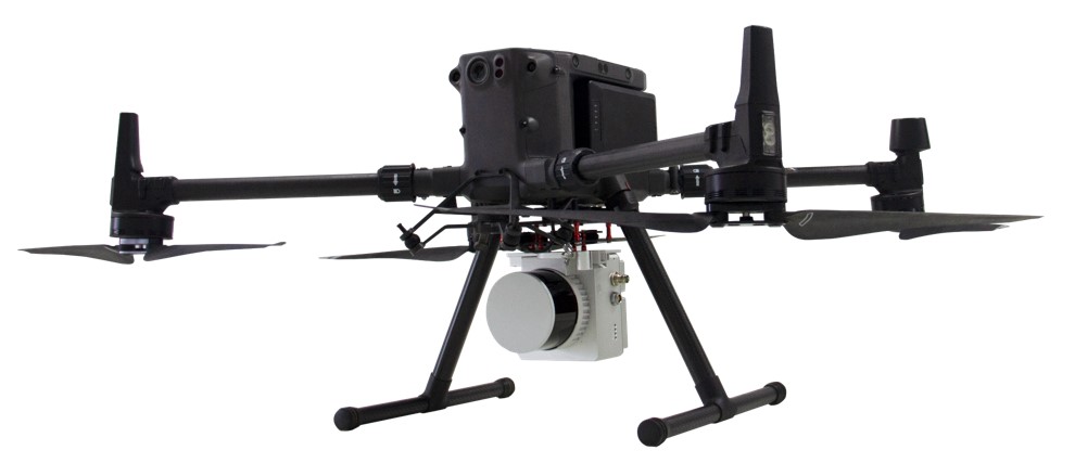
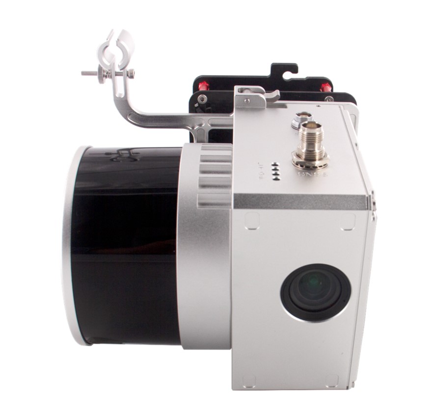
Geospatial Research Ltd, a leading LiDAR Survey Company in Nigeria aim to demystify the intricacies of UAV LiDAR, addressing commonly asked questions ranging from its functionality and alternatives to its benefits and optimal applications. Throughout this series, we’ll delve into key considerations for purchasing and utilizing UAV LiDAR systems. Overview of UAV LiDAR Technology LiDAR, […]
Unmanned Aerial Vehicles (UAVs), colloquially referred to as drones, have swiftly become indispensable instruments in various industries. Their ability to reach remote or perilous areas, capture aerial imagery, and collect data with remarkable precision has transformed numerous sectors. Drones offer versatility in supporting diverse payloads, including cameras, sensors, and LiDAR solutions. This flexibility positions them […]