UAV LiDAR Solutions for Accurate Topographic Mapping
Mines operate in a dynamic environment with ever-changing terrains, demanding accurate and up-to-date information for efficient operations. Inaccurate measurements, particularly in coal or iron ore mines, can lead to inefficiencies and impact project outcomes. Traditional survey methods, reliant on GNSS and total station equipment, often pose safety risks, are time-consuming, and lack the global visualization required by modern mines. This is where Light Detection and Ranging (LiDAR) surveys, especially those conducted with Unmanned Aerial Vehicles (UAVs), emerge as a transformative solution.
The Power of LiDAR in Mining Optimization
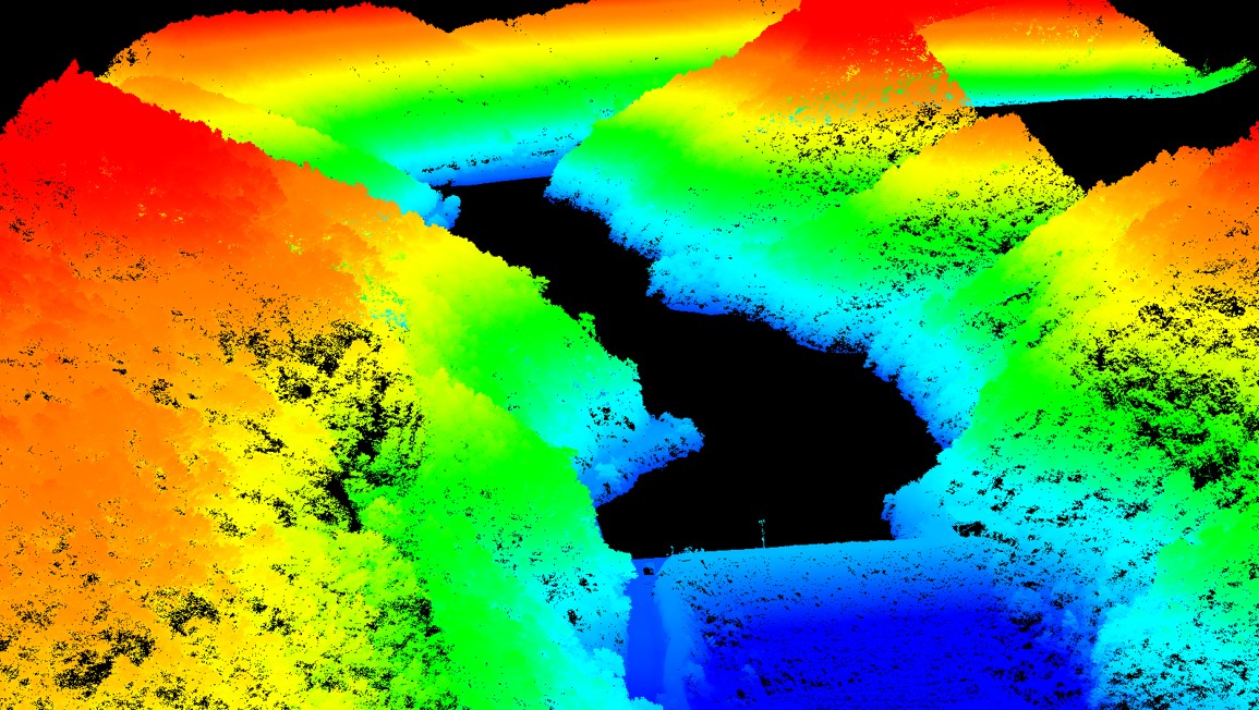
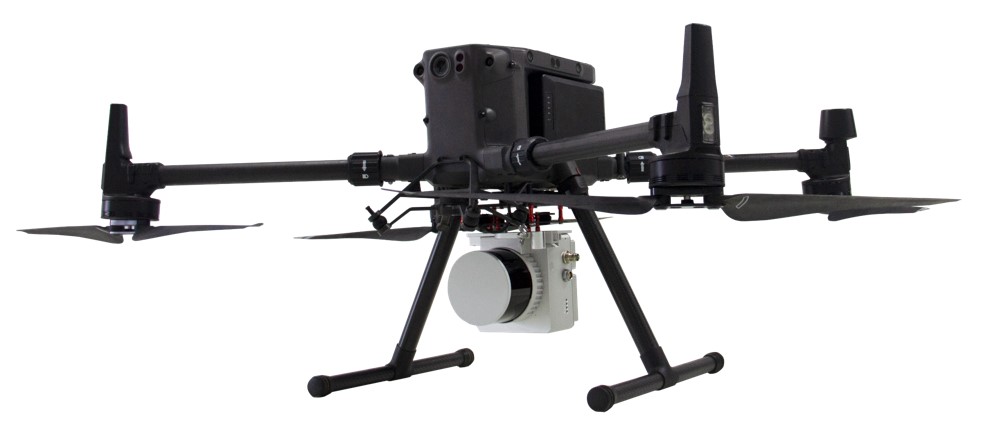
LiDAR, a state-of-the-art surveying and mapping technology, when mounted on drones for mine surveys, enables the measurement of three-dimensional coordinates with unparalleled precision. Unlike traditional methods, UAV LiDAR penetrates vegetation and employs point cloud filtering, resulting in high-precision Digital Terrain Models (DTMs). This article explores a case study conducted in a typical mine site environment using the Geosun 100C LiDAR System, DJI Matrice 300 RTK Drone, gAirHawk5.0, and Global Mapper software
Three Steps to Conducting a UAV LiDAR Survey for a Mine Site
Step 1: Perform the Airborne Survey
Utilize a high-performance package; Geosun 260X LiDAR System and DJI Matrice 300 RTK Drone. The Matrice 300 UAV, designed for industrial applications, boasts a swift setup, and the Geosun 260X LiDAR system is an all-in-one solution with high-precision capabilities. These tools, in combination, offer a seamless solution for mining surveys, topographic mapping, and more.
Step 2: Data Processing for 3D Point Cloud Generation
Transfer raw laser, camera and POS data, merge it with trajectory using gAirHawk software, and generate files in LAS format in the required coordinate system. The gAirHawk software facilitates one-click automated processing of point cloud, picture georeferencing, colorization, depth map creation, and results output.
Step 3: Calculate Mine Site Volume
Use Global Mapper software for importing point cloud data, extracting ground point cloud parts, selecting or importing range lines, generating volume calculation results, and producing reports. This step ensures a comprehensive understanding of the mine site volume and other critical parameters.
Realizing the Value: Feedback from Mine Site Managers
UAV LiDAR surveys are now integral to optimizing mining operations, offering efficiency in data acquisition and processing. Geosun LiDAR solutions, with their accessibility and affordability, contribute to the digitization of mine maintenance and operations. Mine site managers praise the value brought by drone-based 3D data acquisition technologies, emphasizing the role of Geosun 260X UAV LiDAR solutions in their day-to-day operations.