Over 10 years we help companies reach their financial and branding goals. Engitech is a values-driven technology agency dedicated.

Gallery

Contacts

411 University St, Seattle, USA

engitech@oceanthemes.net

+1 -800-456-478-23

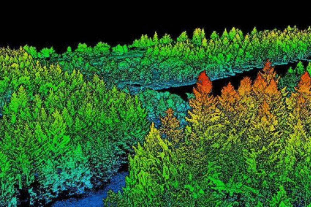
LiDAR image

At Geospatial Research Ltd, we partner with the world’s top LiDAR service providers to deliver advanced LiDAR solutions for projects anywhere on the globe. Using the latest aerial LiDAR technology, including topographic LiDAR and high-resolution RGB cameras, we create detailed terrain and orthomosaic datasets for large areas. With resolutions ranging from 5cm to 30cm, our LiDAR systems penetrate dense tree canopies to capture accurate ground data. Thanks to our collaborations with industry leaders, we access the newest generation of sensors, ensuring every project meets the highest standards of precision, speed, and expertise.

Why LiDAR Surveying is a Game-Changer

LiDAR (Light Detection and Ranging) transforms geospatial data collection. Here’s how:

  • Sees Through Canopy: It captures ground details even under thick forests.
  • Saves Time and Money: It delivers results faster and at a lower cost than traditional ground surveys.
  • Covers Large Areas: It maps vast regions with incredible accuracy, saving time and effort.
  • Provides Rich Data: It offers precise location and condition data, giving you the insights you need.

Where LiDAR Shines: Applications Across Industries

LiDAR’s versatility makes it a powerful tool for many industries. Here’s how professionals use it:

  • Environmental Studies: Track ecosystem changes and monitor conservation efforts.
  • Land Use and Land Cover Mapping: Understand land use patterns and plan for the future.
  • Hydrologic Mapping: Study water systems, from rivers to drainage networks.
  • Digital Terrain Models (DTMs): Build 3D maps of the Earth’s surface for better planning.
  • Agriculture and Forestry: Improve crop management and forest resource planning.
  • Survey Assessments: Conduct detailed land surveys for development and construction projects.
  • Power Transmission Lines: Plan and maintain energy infrastructure with precision.
  • Mining and Exploration: Map terrain to support resource extraction and site planning.
  • Urban and Rural Land Registration: Simplify land ownership and registration processes.
  • Geographic Information Systems (GIS): Enhance spatial analysis and decision-making.
  • Dam Design and Monitoring: Ensure the safety and stability of critical infrastructure.
  • Airport Design and Maintenance: Optimize runway layouts and facility planning.

Why Work with Geospatial Research Ltd?

  • Global Reach, Local Expertise: No matter where your project is, we deliver tailored solutions.
  • State-of-the-Art Technology: We use the latest LiDAR sensors and RGB cameras to ensure top-quality data.
  • Quick Turnaround: We deliver large-area datasets fast, keeping your project on track.
  • Experienced Team: Our experts bring years of experience to every project, ensuring the best results.

Whether you’re tackling an environmental project, planning urban development, or managing infrastructure, Geospatial Research Ltd has the tools and expertise to help. We provide reliable, high-resolution LiDAR solutions that make your work easier and more efficient. Ready to get started? Reach out today, and let’s discuss how we can support your next project.